

|
|
||||
| Home | Shops | FAQ | Site Map | ||
Paddling Possibilities in Maine’s Penobscot BayWith its relatively protected waters and hundreds of wooded islands, its miles of undeveloped coastline and unspoiled fishing villages, its traditional tall-masted wooden windjammers and abundant wildlife, Penobscot Bay offers some of the best kayak touring anywhere. |
|
  |
Penobscot Bay itself is Maine’s largest, extending 20 miles wide from Whitehead Island (south of Spruce Head) in the west to Isle Au Haut (south of Deer Isle) in the east. It extends 28 miles from the entrance to the bay to the mouth of the Penobscot River between Stockton Springs and South Orland. Scattered amidst this 300 or so square miles of semi-protected salt water are hundreds of islands and countless ledges, some barely large enough for a single seal to take a nap. Others are among the largest on the Maine coast and have roads and year round communities. These islands are frequented by many species of waterfowl and nesting sea birds. Eagles, osprey, seals, dolphins, and even whales call this region home. Also plentiful are lobster, urchins, scallop, and clams, which are all quite aggressively sought by local fishermen. |
|
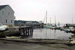
Penobscot Bay offers tremendous variety in terms of sea conditions and sights, and – time permitting – you will want to sample them all. For day trip purposes the bay can be divided into seven regions. In a clockwise direction, moving from east to west, these regions are: Muscle Ridge Islands: a picturesque chain of two dozen small rocky islands and hundreds of ledges amidst the narrow Muscle Ridge Channel, just a few miles offshore. Lobster fishing is a big activity in this area. Expect to encounter numerous lobster boats – and, with any luck, an equal number of seals. Launch Points include South Thomaston, Ash Point, and Spruce Head Island. North Haven and Vinylhaven: these are two large unspoiled islands of spectacular beauty at the center of Penobscot Bay. Sometimes called the Fox Islands, they are accessible by ferry out of Rockland. More experienced paddlers may be able to reach them by paddling out of Rockland, which involves a crossing of about 6 miles. Once there, hundreds of day trip possibilities await the imaginative paddler. Don’t miss Pulpit Harbor, The Thoroughfare, and Winter Harbor. Put ins include town docks of North Haven and Vinylhaven. Both islands have camping facilities. |
 |
 |
The Western Shore: This stretch of coastline includes the lighthouse and rugged cliffs of Owls Head, the historic scenic boat filled harbors of Rockland, Rockport, and Camden. Each of these postcard perfect harbors has traditional wooden windjammers that take tourists out for day and overnight cruises. Camden is also location of a state park with coastal mountains that rise sharply above the village. Launch points include the town docks at Rockland, Camden, and Rockport Harbors. Islesboro: A long narrow island lined by summer homes, estates, and year-round houses. More than 10 miles from end to end, Islesboro is an average of just one or two miles wide – and there are sections in the middle that can be traversed with portages of just a few hundred yards. Islesboro is just 3 miles off from the mainland and can be easily reached by paddling or by ferry out of Lincolnville. Launch points include the Lincolnville town beach, Ducktrap Harbor, Saturday Cove, and Bayside town dock. Launch points on Islesboro include Grindle Point and Warren Island. |
|
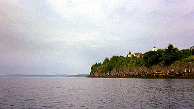
The Northern Shore (Belfast, Searsport, Stockton Springs). These are quiet waterfront towns yet unspoiled by tourism. Each includes a small working harbor and opportunity to paddle in protected waters. Highlights include Sears Island (the largest undeveloped island on the East Coast) and Fort Point with its lighthouse and rugged cliffs. Launch points include Belfast town dock, Searport town dock, Sears Island causeway, and Fort Point State Park on Cape Jellison. |
 |
|
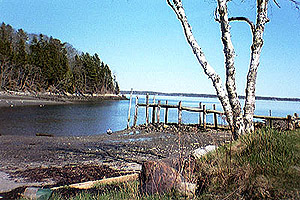
Castine and Cape Rosier: Historic and quaint Castine is at the mouth of the Bagaduce River. This area offers the best of both worlds for paddlers: the protected waters of Bagaduce River and the exposed headlands of Cape Rosier. Reversing tides can be found at several locati300 ons on this peninsula. Sit and marvel while you eat lunch – or put your boat in and play. Launch Points include the Castine town dock and Holbrook Island Sanctuary. |
|
 Return to Water Walker Articles |
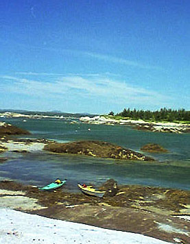
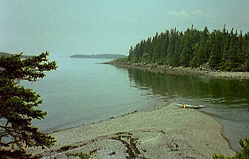
Deer Isle & Isle Au Haut: Between Eggemoggin Reach and the open ocean south of Isle au Haut is (as described by the Maine Island Trail Association brochure) "One of the most beautiful island regions in Eastern North America." This is probably an understatement. This area contains deep bays, inlets, and a multitude of wooded islands, no two of which are alike -- most of them strewn with boulders of pink granite. Famed Isle au Haut is part of Acadia National Park and is reachable by ferry out of Stonington. More experienced paddlers may be able to paddle the distance, involving a crossing of about 6 miles. Launch points include the Deer Isle and Stonington town docks. |