 |
 |
||||
| Home | Shops | Resources | Site Map | ||
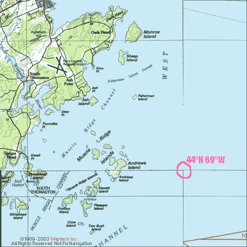 |
44°N 69°WVisit to a Maine Confluence: Muscle Ridge IslandsMaine has 11 confluence sites -- places where major latitude and longitude lines intersect. As of summer 2003, 10 of those sites had been visited and documented at www.confluence.org In July, Ray and Roland Wirth set out to "bag" Maine's remaining confluence. |
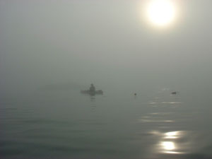 Checking the chart before heading out into the fog. |
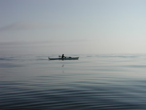
31-Jul-2003 -- We left at 4:45 AM for the 30 mile drive from Belfast, Maine to Owls Head, Maine. At Owls Head, we put our sea kayaks in at Ash Point and paddled through dense fog out to Ash Island and then took a compass bearing south across the Muscle Ridge Channel (dodging lobster boats in the low visibility soup) toward Otter Island. We continued past High Island and Andrews Island, and then followed a GPS bearing another 1.9 nautical miles to the confluence spot. As we left the Muscle Ridge archipelago, we paddled out of the fog and into brilliant sunlight and gentle swells. Harbor porpoises played beside our kayaks as we stopped at the confluence to take photos. Two Bush lighthouse, Andrews Island, Green Island, and Matinicus Island were all visible from the Confluence. The mainland about 4 miles away was still shrouded in fog. On our return trip -- with the fog lifting -- we saw harbor seals, blue heron, loons, and guillemots. We returned to our launch site by 9:30 AM feeling we had seen a lot in a few short hours. | |
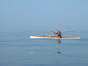
 Roland Wirth heading from Andrews Island out to the confluence
site in a QCC Q600X. Roland Wirth heading from Andrews Island out to the confluence
site in a QCC Q600X.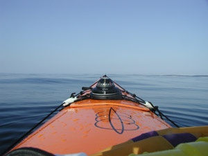 Looking west from the confluence site. |
 Ray Wirth heading out the the confluence site in a QCC Q700X. 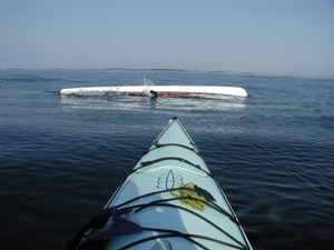 Oops! A failed Eskimo roll at the confluence. (Depth apx. 100 feet, water temperature apx. 58 degrees, nearest land 1.9 miles distant). Stayed in the boat and rolled up on the next one though.
| |
| The goal of the Degree Confluence
project is to encourage people to visit each of the latitude and longitude
integer degree intersections in the world, and to take pictures at each
location.
The
pictures, along with a narrative describing the adventures it took to get
there are then posted on the Degree Confluence website. This creates an
organized sampling of the world. Another goal is to document the changes
at these locations over time. Although the goal of the project is to visit
as many different locations as possible, they also encourage adventurers
to revisit confluences that have already been visited and documented. You're
invited to help.
There
is a
confluence
within
49 miles (79 km) of you if you are on the surface of Earth. For more
information on the Degree Confluence project, please see http://www.confluence.org/ If you visit a Confluence spot by sea kayak or other hand-powered boat, please consider submitting your description and photos to Kayakshops.com as well as directly to the Degree Confluence website. |
||
| More articles
by Ray Wirth Articles Water Walker Home |