| Sears Island |  |
Sea Kayak Trip |
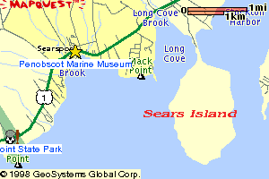
| Penobscot Bay, Maine The Road Trip: From the South: Driving north on Route 1, pass through downtown Searsport and continue north for 2 miles. Turn right and go about one mile to the far end of the causeway. From the North: Driving south on Route 1, pass an exit to Stockton Springs on your left (look for Barb's Diner) and continue south for 2 miles. Turn left and go about one mile to the far end of the causeway. |
 |
||
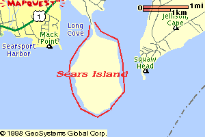
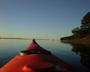
| The Paddle Trip: Trip Summary: An especially varied and scenic cruise along the undeveloped shoreline of Sears Island, the largest undeveloped island on the east coast, now owned by the good old State O' Maine, which hasn't quite yet figured out what to do with it. (They could do worse than keep it just like it is). The Launch: Put on on the left side of the causeway for a clockwise circumnavigation. The sandy bank (no guardrail here) on the far end of the causeway is probably the best spot. Distance: 4.5 nautical miles. Paddling time: 1 - 2 hours. Tips: If the wind is out of the south or west, its best to circle the island in a clockwise direction. The east side is more protected and is usually calmer. Currents at the southern tip of the island can be tricky on an incoming tide. A sea kayak is suggested for this trip, especially if you want to go all the way around the island. Natural Features: undeveloped sand and rock beaches interspersed with granite cliffs. Lots of shorebirds. Views of the Camden Hills from the west side. Turtle Head on Islesboro is less than 2 miles from the southern tip of the island. Other Landmarks: A tall communications tower rises up from near the southern tip of the island. About a mile from the causeway on the west side is a large stone jetty built by the state (before the DEP stopped their plans to build a cargo port here). Mack Point, its piers, slag piles and cargo ships is a prominent eyesore on the west side. Stretch Your Legs: On any of the many sand (well, close to sand) or pebble beaches, or on the high bluff at the southern tip of the island, which makes a good picnic spot. One Paddler's Story:Ray Wirth has sea kayaked this trip in every month but January. It's his dog Rugby's favorite because he gets to run along the shore. 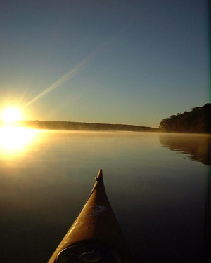 |
  |
||
 |
 Water Walker Sea Kayaks: |
||
| Previous Trip | Next Trip | List of Trips | Submit a Trip | Home |